Friday 22 September 2017

Sonderborg, Denmark - Burgstakken, Germany (15 September 2017)

On a wet and gloomy Wednesday morning we slipped our lines at around 0830 and in company with two German boats started heading SW towards Schleimunde, the entrance to the Schlei fjord. We were able to sail with a moderate S wind and completed the 20nm to the narrow entrance to the fjord in good time. Passing through the entrance into a tight buoyed channel, we were immediately dodging tripper and fishing boats and then we motored some 4nm to the town of Kappeln, mooring at a sailing club about half a kilometre from the town centre.
Kappeln itself is fairly ordinary but there is a busy road crossing in the town, with a bridge refurbished about seven years ago.
The bridge at Kappeln
In the afternoon we looked around what was a mainly modern centre. 
Perhaps not the best name for a driving school?
But there was an impressive Police HQ and a traditional windmill on the fringes.
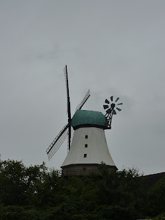
Smart windmill
The following day we drifted down to the bridge which opens at 15 minutes to the hour and then continued down river.
For the next 20 nm depths outside the channel were typically 3 metres, with perhaps a little more in the channel itself. After waiting for the opening of the bascule bridge at Lindaunis, shared by rail and vehicular traffic, we continued down river through pretty countryside with sometimes wide lakes and then narrow channels between land.
Waterfront location on the Schlei    
Eventually we reached Schleswig, the navigable head of the Schlei. This was an interesting mixture of old and new. On the way into the town centre we visited the Cathedral of St Nikolai, an impressive building with some highly skilled carvings.
Impressive work
We also had the opportunity to climb the high tower which gave good views once breathing had returned to normal!
Looking across one part of the town towards the Yachthafn
Best of all was the traditional fishing village of Holm, well preserved small houses in a very attractive setting.
One side of the square in Holm
The next day we returned up river to Kappeln in continuous driving rain although with some wind behind us we were able to sail. Frustratingly there was some sort of problem with the very rusty bridge at Lindaunis which meant that one opening failed to materialise. As a result two German boats and ourselves had to wait for about an hour and three quarters for the bridge to open, with no explanation as to why! Once through, after about another 6nm, we had to wait for the newer town bridge but this did open punctually. We again moored just N of Kappeln. The town has many restaurants so good quality food is very reasonably priced, especially those with fish!
We were now anxiously watching the weather for a week ahead. Such medium term forecasts can be unreliable, but we had noted that a deepening low with attendant high winds seemed to be a permanent part of the forecast for our last seven days. We had various options on where to go next and if that element of concern hadn't been part of the forecast we would probably have stayed longer in the Schei. But as it did, on Saturday we opted for a 46nm passage to Heiligenhafen. With S and SW winds forecast we were looking forward to our trip SE. After two hours sailing the wind was quickly heading us and became E for the following hours accompanied by heavy rain!
Not the most enjoyable weather .......
We choose to stop at the small sailing club at Heiligenhafen rather than the large marina and found a very welcoming and chatty group of people. We have been to this very busy town before and know that it attracts many visitors. 
The Sailing Club at Heiligenhafen
On Sunday, after some quick shopping we had an enjoyable lunch at a restaurant overlooking the marina. After that we slipped our mooring, picked up fuel and then headed NE, under the bridge linking Fehmarn and the mainland and on to Burgstaaken where we leave the boat for the winter. A pleasant cruise drying out the sails from the previous days rain!
It was the right decision. The winds picked up on Tuesday and by Wednesday evening were a minimum 35kn gusting to over 50kn. Whilst tied to the pontoon it was very uncomfortable. In addition there was a very rare occurrence of a sharp drop in water levels caused by the low pressure and strong winds. The fall from normal levels was nearly a metre, apparently unheard of in Burgstakken. The consequence for us (and others) was that for a while we sunk into the (thankfully) soft mud! We were aground for over 12 hours but no damage was done. Two days later the mast was stepped and Whileaway was lifted out ready for moving into the shed for the winter. 

Part of the quay at Burgstaaken
By Sunday warm and sunny weather had returned and we were able to have our last lunch in Germany in a restaurant on the quay.
So a summer that was constrained by our engine problems but nevertheless we covered some 850nm, visiting 31 ports during the 10 weeks that we were on board. For the most part we had reasonable weather. Now we need to start thinking about next year ..........................


Tuesday 5 September 2017

Rodvig - Sonderborg (5 September 2017)

Monday 28 August was sunny and with light S winds forecast. With favourable visibility this was a good day for our planned passage to Vordingborg which required sailing about 20nm between islands through narrow buoyed channels. But first of all we headed 10nm SSE to the Fairway buoy across the bay which marked the beginning of the channel. To follow the channel we had the paper chart (below) and an electronic chart plotter with a GPS showing our position. But as buoys are sometimes moved to reflect shifting sands (and charts take a little while to be updated), the GPS position has some margin of error and the channel is only about 12 metres wide in places, we also heavily use Mk 1 Eyeball to spot the red and green channel markers and the various cardinals! The chart shows the channels starting top right of centre and eventually leaving this sheet at bottom left. The channel markers and buoys look like small black pillars in the picture.
Part of the passage chart
The shallowest parts of the channel tend to be in the first part going NW to SE and at times we had just 0.5 metres under the keel. With crystal clear waters it was easy to see the seabed and at times the fish! There were very few other boats although we were followed by a German flagged yacht who had caught us up at the start of the buoyed channel and then slowed down to follow us at a careful distance! Spotting the buoys keeps you busy so time passed quickly and after about 7nm we were approaching the small island of Nyord (just below centre right on the chart). This has a very small harbour but looked like it would make a nice lunch time stop. It requires a careful approach from near a buoy that is an isolated danger mark but we never had less than 0.7 metres in the approach. Not much space in this small harbour (and quite a narrow entrance) but we tied up just inside.
The harbour at Nyord
There is a small settlement around the harbour with some very attractive buildings, including a couple of cafes and a small shop. Although an island there is a road bridge to the larger island of Mon but the settlement is very much at the end of a 10km road from the nearest town.
Attractive gardens at Nyord
After lunch we resumed our passage, now through wider and a little deeper channels, passing Kalvehave were we stopped last year and on to Vordingborg for the night. This has a poorly marked entrance from the channel and in places is very shallow. We attempted one approach from the main channel towards their marked channel and lost our nerve when the depth was showing as 0.3 metres under the keel. So we turned back and tried another approach from the main channel, this time reaching the long channel to the marina with the luxury of a minimum depth of 0.5 metres. Our passage from Rodvig had been 32nm.  It was another beautiful evening. We had also stayed at Vordingborg, with its castle remains, last year, so it was just an overnight stop this time.
The following morning we again had light S winds forecast as we headed E under the road/rail bridge (26 metres minimum clearance) and then NE through the Karrebaeksminde Bugt. This turned out to be a very warm day with winds of F2/3, maximum about 12 knots. We did sail for about half the time but each time as our speed dropped to 2-3 knots we had to give up for a while. Still a very leisurely 37nm to the small island of Omo arriving about 1700. A small guest harbour, about one third full, but all German boats apart from ourselves, one Dane and a Dutch barge!
Fishing harbour (with barge alongside) at Omo
Omo is served by a ferry which comes from the large island of Sjaelland about every two hours. It stays for about 10 minutes to unload and take on a few passengers and an occasional car or delivery lorry.
Ferry going astern into the harbour
Having enjoyed some warm and sunny weather it turned wet but warm overnight so the next day started with heavy rain. The island was very misty throughout the day and did not look at its best. Nevertheless we cycled to the main settlement in the centre of  the island and visited what was a well stocked shop for an island of 170 people.
Welcoming carving at the entrance to the main settlement
It is clear that the island must be much busier in the main holiday time as there are quite a few summer cabins and houses.
Holiday home
But agriculture is still a mainstay of the economy and on cycling round we came across some of the deer, hares, pheasants, herons and other birds - plus numerous horribly fat brown slugs!

Startled deer!
The following morning saw little improvement in the weather. It was gloomy under heavy skies and with the threat of rain. Nevertheless we set off about 0930 to head E sailing a few miles off the N coast of the island of Langeland which is surrounded by shallows. Initially we sailed with a N wind of F4 on the beam. Having tacked a couple of times as the wind came around to NW and strengthened to the top of F5 together with a current pushing us S I decided that we should motor the last 4 nm to the narrow gap in the shallows N of the island. Once we did that we turned SW and with the wind behind us it was much more pleasant. After a couple of hours sailing we turned W then N into the narrow sound leading to Svendborg. However our destination was just short of that town, being Troense on the island of Tasinge. We tied up about 1530 and briefly explored the area around the Sailing Club where we had berthed.
Many Danish Harbours now rely on automatic machines to collect your berthing fees but Troense still has a Harbour Master. As the gentleman resplendent in peaked cap with gold braid, smartly attired and with his cash bag around his shoulders approached, Andrea remarked “Now that's what I call a Harbour Master”!
Impressive HM!
A little later we could hear a loud rhythmic clanging of an engine. Svendborg has an excellent collection of historic craft and some enthusiasts were exercising a little work boat around the bay.
Steam driven work boat
On Thursday, after cycling to the supermarket a couple of miles away we went a mile in the opposite direction to visit Valdemars Slot (Slot being the Danish name for Castle). This grand house has a splendid position commanding the entrance to the channel to Svendborg so we had seen the outside of it. It was built in 1639-44 By King Christian IV for his son, Count Vlademar Christian. But he never lived there and was killed in battle in 1656 at the age of 34. During the war with Sweden (1657-60) the castle was occupied and badly damaged. When Danish and Swedish naval forces met in a sea battle in the Bay of Koge, the Danish Admiral Niels Juel defeated the Swedes and captured a large number of ships. The King, being short of gold at the time, gave him the castle and the estate in lieu of the prize money that he was entitled to. Juel initiated an extensive renovation and created a monumental baroque house from the rebuilding. Today it is owned by Alexander Fleming, the twelth generation of the Juel dynasty.
Valdemars Slot
There are 17 rooms in the house open to the public mostly with appropriate furniture, historical paintings and collectables. What we were taken aback by was a huge attic which has a “Trophy hunting and ethnography collection” mainly that of a famous (apparently) Danish hunter, Borge Hinsch. It is a little disquieting to be in a large area full of stuffed wild animals and birds with pictures of the hunters celebrating their kill. There were also information boards justifying trophy hunting but Andrea and I find it rather a strange activity!
We did enjoy the house and the history and also had an excellent traditional Danish lunch in the restaurant. 
Traditional lunch
We cycled a round about way back and found some pretty Danish houses and villages.
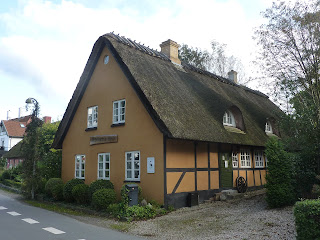
Attractive thatched homes
One other feature we saw a number of times was the traditional ferry “Helge” as she took tourists and others around the bay stopping at, amongst other places, the Slot and the Sailing Club. Fine looking vessel.
Helge approaching landing stage
Saturday morning was sunny; we couldn't believe what a good spell of weather we had enjoyed since returning in August. The downside was that the wind was again very light so all we could do was motor the 19nm W past Svendborg on the island of Fyn and three small islands off the coast of Fyn until we reached Lyo. This is another small island about 4km long and 3 km wide with a population of around 200. The very pretty village is in the centre of the island about 15 minutes from the small harbour where the ferry calls about five times a day. 
The village pond in Lyo
The whitewashed Church has a circular graveyard, claimed to be the loveliest in Denmark! No information on whether the incumbents agree! It is certainly well maintained with miniature box hedges around every plot and many flowers and shrubs. 
The praised Chruchyard!
From there we walked to the NW of the island passing a Dolmen from the early stone age and then being able to view the reef and bird sanctuary. This is a flat triangular spit surrounded by a salt meadow. Many birds breed here earlier in the year, particularly arctic terns, little terns and avocet but regrettably we couldn't spot any of these.
Bird sanctuary
The following morning we decided to thread our way around the islands the short distance to the town of Faaborg which we had visited last year. We achieved three objectives. We fuelled the boat; did some shopping at Lidl; and had a smoked fish lunch at a popular little cafe on the edge of the harbour that we had visited last year. After lunch we returned the 5nm to Lyo but instead of mooring in the harbour we joined a couple of other boats anchored off the sand spit and had a peaceful evening and night in the bay.
Beautiful evening anchored off Lyo
On Monday we weighed anchor and headed NW towards the island of Als. Despite the wind gradually becoming WNW we were able to sail for a while as we headed to the N of the island. We rounded this and then turned S and with the wind having dropped slowly made our way through Als Fjord and then into Als Sund both of which separate the island from Jutland. Both the Fjord and the Sund are beautiful with rolling hills running down to the waters edge. 
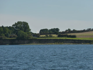
Als Sund
After a 30 minute wait for a lifting road bridge on the edge of the town we tied up alongside the town quay in Sonderborg.
Whileaway on Sondorborg Town Quay
The busy town is a large shopping centre and has a mix of old and new buildings, some of the latter the usual concrete eyesores that you see in many places! It is a University town so that adds to the buzz.
New buildings dwarfing the old
Sonderborg is very near the border with Germany so has suffered from incursions! The Prussians took possession of Jutland in the 1864 in a war in which the Danes were forced to retreat to Als. After WW1 the population were offered a referendum on whether they wished to return to Denmark and they voted to do so, the change happening in 1920. Of course, during WW2 the Germans again occupied Denmark. Not surprisingly the second language here is apparently German rather than English.
In the afternoon we cycled 10km down the coast on an excellent foot/cycle path to Horuphav, a sleepy village with a small harbour. 
Basking seals sculpture on coast path
It was another warm and sunny day although with cloud building. Looking at the forecast it seems that we are now in for a period of rain and strong winds as a low that has been bringing poor weather to the UK, is set to push away the Baltic high that we have been benefiting from.


Monday 28 August 2017

Ystad - Rodvig, Denmark (27 August 2017)


We returned to Ystad after a brief visit to the UK for a wedding. This journey took some planning as we were bringing the car as we had quite a few items to bring out and would have other items to take home at the end of the season. We took the usual overnight ferry to the Hook of Holland and despite being much busier than we are used to we were through customs 15 minutes after docking. We then drove for seven hours to Burgstakken on Fehmarn Island in Germany as it is here that “Whileaway” will spend the winter. Having parked the car in one of the sheds where yachts are later stored we then stayed in Puttgarden on the N of the island for the night. Early the next morning we had a short 15 minute walk to the ferry that goes across to Rodby in S Denmark every 30 minutes and takes 45 minutes. This service is extremely popular with Danes, hence the existence in Puttgarden of a huge “Border Tax Free” shop. Of course not really tax free but taxed less in Germany than in Denmark particularly alcohol and cosmetics. By 0800 we were waiting for the train that took us to Copenhagen. There we changed to another train that took us over the Oresund Bridge to Hyllie just outside Malmo; where we changed again to the train to Ystad. All smooth, comfortable, on time journeys of course!
The weather forecast for the next morning was for a brisk wind from the NW. That would enable us to sail WSW initially along Sweden's S coast and we did so for the first three hours. However the wind then turned into mainly W, so right on the nose and we then ended up motoring. On the SE corner of Sweden is a large peninsular, Skanor, so at a narrow point the Falsterbokanal has been built. Less than 2nm long it saves a journey of about 15nm!
Approaching Falsterbokanal on a sunny afternoon 
The road on to the peninsular is at the N end of the canal and there we were forced to wait 45 minutes for the bridge to open on the hour. Just the other side of the bridge is the sailing club harbour of Hollviken and having done 36nm that day we decided to stay there for the night.
The following day we opted to head N up the Oresund to the island of Ven. A light N wind was forecast so again it was the motor doing the work, especially as we started off having to follow a buoyed channel for 7nm through shallows. We emerged to head under the Oresund Bridge (“The Bridge” for aficionados of Scandinavian thrillers!). As we headed N the wind strengthened and the sound became more choppy for a while. But just after 1500 we entered the main harbour of Kyrkbacken.
Alongside in Kyrkbacken
This was the third time we had been to this Swedish island – but the first on which we found space to stay! Our two previous visits had been in mid to late July the year before and both times the harbour was absolutely stuffed! Now the Season is nearing its end and there are fewer boats. Ven's attraction (apart from being a very pleasant island), is that it is in the middle of the Sound, about 3nm from Sweden and 5nm from the Danish coast. Thus ideally placed for day trips or short stop overs. On this bright sunny afternoon it had quite a few visitors but by the evening many had left.
Ven's main claim to fame is having been the home of  Swedish astronomer Tycho Brahe who built a castle and an underground observatory in the 16 century. The remains (and partially reconstructed) of the latter are much publicised.
In the afternoon we went for a short walk up to the medieval St Ibbs Church on the cliff top from where there are excellent views across to Denmark. The following morning we set off on our bicycles and went first to the centre of the island (about 1km) where there was a bakery. This was truly artisan, ran by an old lady in an old building! 

The bakery
The shop!
We then followed a few roads and cycle paths covering much of the island including Backviken which is where the ferry from Landskrona in Sweden arrives. When the ferry arrived there were many walkers and also those who went a short distance to the cycle hire centre. This is obviously the most popular way to tour the island as the enormous cycle parking area showed!    

Just a part of the cycle renting park!
 On Friday morning there was a brisk WSW wind as we set off for Copenhagen. We had a fast two hour sail until near the entrance when we dropped the sails and motored past a departing sea plane!
Unusual hazard to navigation
We then passed a cruise ship and the Little Mermaid, avoiding the numerous tripper boats and then turning to port immediately before the new harbour bridge and into the Trangraven Canal. The Trangraven pedestrian (and cycle) bridge opens on the hour and although it was 1110, disappointingly it was only just closing! But we were too late, so we tied up at the waiting pontoon. An hour later we turned into the Christianshavn Canal and then into Wilders Platz, a short offshoot, where we had booked a space for two nights. So we were close to the centre of Copenhagen.

Whileaway (centre right) alongside converted warehouses in Wilders Platz
We had a good visit to Copenhagen last year, our main purpose this year was to take the 25 minute train journey to Roskilde. We could have sailed there but the passage would have been some 80nm (in the wrong direction for subsequent plans) instead of 15nm to Copenhagen in the right direction!
Roskilde was once Denmark's capital. Our interest was in seeing the Viking Ship Museum (Andrea for a second time). The exhibition includes the remains of five unique Viking Ships excavated in 1962 from Roskilde Fjord.

Viking warship remains
At the end of the late 11th century a system of barriers was constructed in the fjord to protect the royal seat and the cathedral. The ships had been sunk across a sailing channel as part of the barrier. The boat builders have also built reconstructions of the five ships (and other Viking craft) based on original surviving ship finds. These ships are in the boatyard at the museum and all have been sailed one as far as the Shetlands, Britain and Dublin where it seems it was originally built! An excellently presented museum.
One of the reconstructed Viking ships
Later we visited Roskilde Cathedral, a UNESCO World Heritage Site. The first Church on the site was built by Harold Bluetooth who died around 985. A couple of others followed until the present brick built Church was stated in the 1170s.
Cathedral interior
The Church is on the World Heritage List because it is an outstanding example of one of the earliest ecclesiastical buildings in brick (a new material in Europe in the 12th century). The Cathedral contains the burial places of many members of the Danish royal family. It includes a chapel intended to house the "future sepulchral monument for the present royal couple, Queen Margrethe II and the Prince Consort"!
On returning to Copenhagen after 1900, Saturday night activities in the city centre were well underway. But a revelation to us were three new style vehicles powered by pedal. The "cyclists" sit around a central bar from which they help themselves to beer and other drinks. They sit at stools which have pedals attached to propel the vehicle. It is steered by a (presumably) non-drinking driver who stands behind a wheel.
The bar cycle!
Presumably the vehicle gets slower as the evening wears on?
On Sunday morning we slipped our mooring in time for the 0900 bridge opening and were soon greeted with heavy rain (not forecast), the first in daytime since we had returned to Sweden since early August. After initial light winds (forecast for the day) the strength increased to F4/5 and we had an excellent sail SSE to Rodvig, 35 nm away. Arriving mid afternoon we tied up in the Fishing Harbour.
Fishing Harbour, Rodvig
We have visited Rodvig and round about before so apart from a wander round the village we stayed on the boat enjoying the warm afternoon and evening sunshine. As there is a fishmongers on the quayside it was fresh fish for dinner!

Swallows having a break from collecting breakfast
In the early morning the swallows were very active skimming across the water catching tiny midges and flies, a sad reminder that autumn is on its way and they will soon be off to warmer climes. 


Tuesday 15 August 2017

Karlskrona - Ystad (15 August 2017)

Our return trip to "Whileaway" took 23 hours. I had booked return flights from Stockholm earlier in the summer but our engine problem meant that we had ended up much further away from the capital than expected. However a late change to the airline tickets was prohibitively expensive so we flew there, had dinner then took the comfortable night sleeper train south. Unfortunately we had to change trains to a local service at 0550 but then arrived back in Karlskrona a little after 0800.
Back to Sweden, where either flag is flown by residents
We had received an email from the engine engineers saying that they had found and fixed the problem a few days before we left the UK. The first task was therefore to start and run the engine to see if I agreed! All seemed fine so I cycled off to the engineers office to pay the bill and learn that they had discovered a blocked exhaust pipe. This carries both gas and the sea water used for cooling the engine and it was the seawater element that had gradually blocked over the years. As a consequence of the problem two other rubber caps which had been put under intense pressure had also failed and had to be replaced.
So we were ready to go but the weather wasn't being accommodating! There was a strong wind blowing that morning with a forecast that showed a significant increase over the following couple of days. So we decided to stay put (and weren't the only ones!); and indeed by early Saturday morning the boat was rocking and rolling even in the harbour as winds reached F6 gusting F8 (over 30 knots). But we had plenty to enjoy in Karlskrona as it was the annual Archipelago Festival with various entertainments, games competitions, music, food and so on.

Circus training for young children at the Archipelago Festival
On Saturday afternoon we took the local bus to the nearby settlement of Nattraby. This was a very attractive extended village. It is on the coast so we saw the arrival of the historic ferry "Axel" which comes from Karlskrona three times a day.

Axel in the approach to Nattraby
By Sunday morning the wind had abated a little and we were keen to move on so we decided to head for one of the outlying islands, Hasslo. It is fair to say that this was a rather lumpy passage especially once we were in open sea. We had to head into a still strong E wind and once we were into open waters the sea was moderate at best. But Hasslo was only 11nm, approaching 3 hours, in these conditions. The final approach was a buoyed passage between numerous rocky shoals but was fine and then we were into calmer waters as we entered the small harbour at Garpahamen. I started visually checking for a place to moor, taking a circuit around the harbour and within a short time the depth under the keel dropped rapidly until we were aground on mud! Twenty minutes of engine running, lightweight anchor being deployed (to haul us into deeper water), then rocking up and down on the bow eventually freed us and we returned to deeper water and then to the top of the harbour alongside a pleasant and helpful Danish couple. A cycle around the island took us about 90 minutes but confirmed how keen the Swedes are on having their summer houses.
View of the approach to Hasslo from the harbour breakwater
Our next passage was 16nm E down the coast to Ronnebyhamn and by now the wind had abated to F4/5 (maximum about 20kn) and it had turned SW so we got in a little sailing and then motor sailing. Again the final approach over the last three miles involved close attention to buoys keeping us off the rocky outcrops and finally a very shallow area where at times we had less than 0.5m beneath the keel. But Ronnebyhamn was a very pleasant small coastal community and we tied up with a lovely view across the water.
View across to Karon from the marina
 We did cycle the 5km to Ronneby and decided that the town was rather ordinary, with some attractive older properties but quite a few relatively modern nondescript additions particularly amongst the shops. In addition the planners had clearly paid homage to the highwaymen and busy roads crisscrossed the town seemingly needlessly. The following day we took the ferry a short ride across to the island of Karon. Apparently most of the 30 or so homes here were built in the 18th century and the island is very unspoilt. No traffic, no facilities, no shops or cafes, so a very pleasant ramble along tracks and through woods around the island.
Summer House on Karon
After a couple of days time to move E again. A choice here. we could either return to the open sea, set a course due E and then near our destination head N; or we could weave our way between many rocks and islands within the Hallaryd archipelago. In fact, we learnt later, there are over 270 inlets and islands of various sizes with rocky or craggy shores, broad-leaf copses and meadow lands in the Archipelago. By now the wind had eased down to around 10 kn or so and we decided to test our navigational skills and follow the inside route. It certainly brought us up close to many islands and rocks and with opportunities to see the bird life at close quarters. But we did have to concentrate to keep finding the next channel marker and keep us on course.
Passing a rocky island in the archipelago
After 16nm we turned into a sailing club harbour, Hafen Svanevik, just outside Karlshamn. What a delightful place. Not very big, quiet and with lovely views across to some of the islands.
The sailing club Hafen Svanevik at Karshanmn
A walk around the coast took us into the town of Karlshamn where there were some characterful old buildings as well as a few less characterful new ones! Like other places in this part of Sweden it has been part of Denmark at times. passed over as a naval port in favour of Karlskrona, it turned to overseas trading and built very profitable businesses.  The town streets were still adorned with flags and bunting from their recent festival. Especially delightful was the discovery in the adjacent Fish Harbour of a fishmongers and smokery. A few purchases were made and they were very good indeed. The following morning we cycled N along the coast along roads through the woods to small villages before returning and buying more (not smoked) fresh fish for dinner.
Cycling along a road through the woods
Friday morning was sunny and still and we motored 9 miles S to the small island of Hano. The island is only about 2km x 1km and lies about 10nm off the nearest part of the Swedish coast.The island is a large rock of granite with a very unusual natural environment. Whilst the higher parts are large slabs and boulders of granit, lower levels are woods or scrub. Apparently these were formally part of the sea before water levels reduced. We walked on the footpaths around the island before and after lunch. Some of these are granite chippings, some covered in moss or grass requiring you to walk over granite rocks.
Granite rock, trees and scrub on Hano
We climbed to the summit to see the short lighthouse with (so they say) the strongest light in the Baltic. In addition we visited the English Cemetery. This is a piece of naval history dating from 1810-12 during the Napoleonic wars when Hano served as an English naval base. The cemetery contains an unknown number of graves of English sailors.
The Cemetery
Cemetery plaque
The ferry arrives half a dozen times a day, mainly bringing day trippers as there is little accommodation. The only facilities (around the harbour) are a restaurant and cafe, very small and limited shop, ice cream kiosk and a museum.. But it is all very friendly and welcoming.
We awoke on Saturday morning to find that it was foggy; or a soup as the German sailor tied up in front of us said as we peered over the harbour wall into the murk! But the poorer visibility wasn't stopping the swifts swooping over the harbour searching for breakfast. During a rest break quite a few took a few minutes resting on our guard rails seemingly oblivious to us.

Around 0900 we decided to cast off, feeling that we had a potentially longer passage and that this was an area with few big ships. Then right outside the harbour out of the fog appeared a small freighter seemingly waiting to come alongside. After about an hour the fog began to lift and the wind increased so that we were able to first motor sail then dispense with the engine. During the rest of the passage the wind swung between F2 (about 6kn) and F5 (maximum 25kn) making reefing in or letting sails out a regular occurrence. It took nearly 8 hours to cover the 38nm to Simrishamn near the foot of Sweden's E coast, but we found space in the quite spread out marina adjacent to the fishing harbour. For only the second time this summer (apart from our base at Fehmarn) we came across a British sailor, this being Andy on “Hoppetosse”. Over evening drinks on our boat later we learnt that he was on his way back from Helsinki to Fehmarn.
Simrishamn is a town of mainly smaller houses, with some very attractive cobbled streets. 

Typical Simrishamn
In a self-guided tour (courtesy of the Tourist Bureau) we discovered a few of these homes many with the traditional Simrishamn door.
The Simrishamn door!
There is a very big fishing harbour, with a fleet of around 20 boats, although these are probably much below the peak. We had fish and chipped potatoes on an old fishing boat converted to a cheap and cheerful restaurant for lunch. Not so cheap being Sweden of course. Fairly ordinary fish and fried potatoes, with a pint (well 500ml) and a half of local lager was about £28 for the two of us.
Monday produced another sunny morning and we set off for Ystad, just over 30nm away on the S coast. We had brisk winds and although the wind direction was unfavourable at times we were able to sail most of the way and motor sailed when we tired of beating into the wind.
Ystad has a ferry port from where services depart to Bornholm and freight to Poland. It is also an important passage port for leisure sailors being strategically placed in the middle of Sweden's S coast. It is a town of some size with a busy shopping centre and some fine historic buildings. Many buildings and courtyards are very reminiscent of those found in Denmark; hardly surprising as this part of Sweden was part of Denmark for many years.

Attractive courtyard with cafes in Ystad
Even the typical tourist "trains" that take sightseers around the town do not ply their trade here. Instead there are circuits of the town in an old fire engine or two! 
Tourist trip fire engine (behind the smaller fire engine dating from the 1930s)
Traditional street with hollyhocks in full bloom - just like Denmark!

We are leaving the boat here for 5 days to return to England for the wedding of one of Andrea's nephews. Ystad has a train station very near the marina and with one change we can get to Copenhagen Airport. Looking forward to crossing The (Oresund) Bridge on a train!