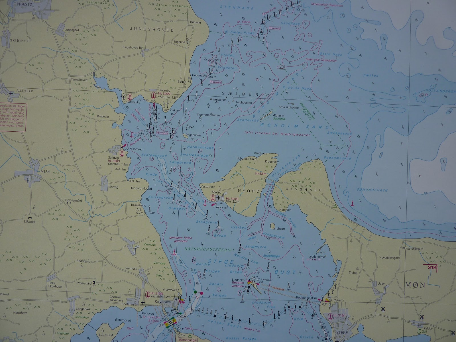
Monday 28 August was sunny and with light S winds forecast. With favourable visibility this was a good day for our planned passage to Vordingborg which required sailing about 20nm between islands through narrow buoyed channels. But first of all we headed 10nm SSE to the Fairway buoy across the bay which marked the beginning of the channel. To follow the channel we had the paper chart (below) and an electronic chart plotter with a GPS showing our position. But as buoys are sometimes moved to reflect shifting sands (and charts take a little while to be updated), the GPS position has some margin of error and the channel is only about 12 metres wide in places, we also heavily use Mk 1 Eyeball to spot the red and green channel markers and the various cardinals! The chart shows the channels starting top right of centre and eventually leaving this sheet at bottom left. The channel markers and buoys look like small black pillars in the picture.
 |
| Part of the passage chart |
The shallowest parts of the channel tend to be in the first part going NW to SE and at times we had just 0.5 metres under the keel. With crystal clear waters it was easy to see the seabed and at times the fish! There were very few other boats although we were followed by a German flagged yacht who had caught us up at the start of the buoyed channel and then slowed down to follow us at a careful distance! Spotting the buoys keeps you busy so time passed quickly and after about 7nm we were approaching the small island of Nyord (just below centre right on the chart). This has a very small harbour but looked like it would make a nice lunch time stop. It requires a careful approach from near a buoy that is an isolated danger mark but we never had less than 0.7 metres in the approach. Not much space in this small harbour (and quite a narrow entrance) but we tied up just inside.
 |
| The harbour at Nyord |
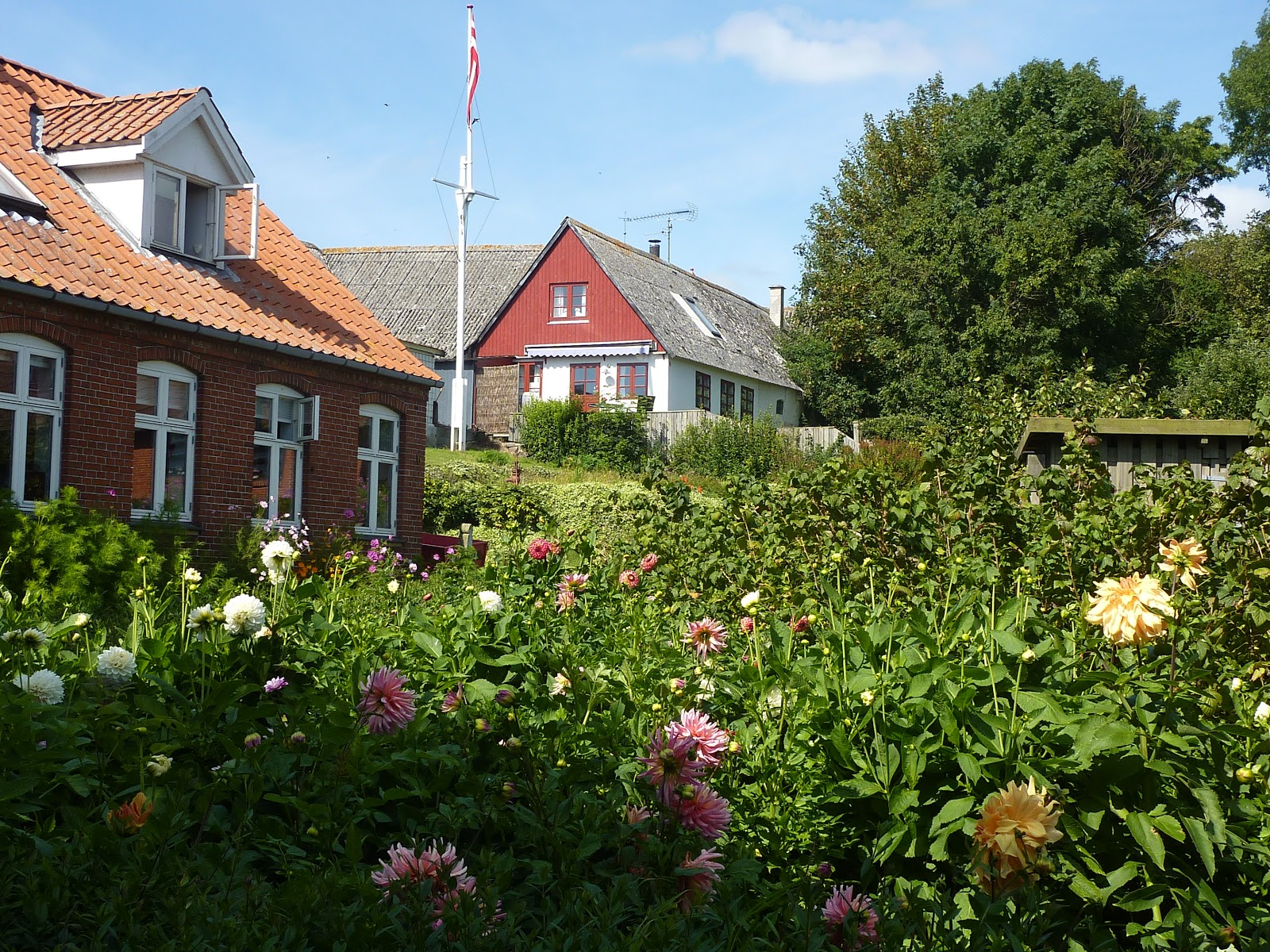
There is a small settlement around the harbour with some very attractive buildings, including a couple of cafes and a small shop. Although an island there is a road bridge to the larger island of Mon but the settlement is very much at the end of a 10km road from the nearest town.
 |
| Attractive gardens at Nyord |
After lunch we resumed our passage, now through wider and a little deeper channels, passing Kalvehave were we stopped last year and on to Vordingborg for the night. This has a poorly marked entrance from the channel and in places is very shallow. We attempted one approach from the main channel towards their marked channel and lost our nerve when the depth was showing as 0.3 metres under the keel. So we turned back and tried another approach from the main channel, this time reaching the long channel to the marina with the luxury of a minimum depth of 0.5 metres. Our passage from Rodvig had been 32nm. It was another beautiful evening. We had also stayed at Vordingborg, with its castle remains, last year, so it was just an overnight stop this time.
The following morning we again had light S winds forecast as we headed E under the road/rail bridge (26 metres minimum clearance) and then NE through the Karrebaeksminde Bugt. This turned out to be a very warm day with winds of F2/3, maximum about 12 knots. We did sail for about half the time but each time as our speed dropped to 2-3 knots we had to give up for a while. Still a very leisurely 37nm to the small island of Omo arriving about 1700. A small guest harbour, about one third full, but all German boats apart from ourselves, one Dane and a Dutch barge!
 |
| Fishing harbour (with barge alongside) at Omo |
Omo is served by a ferry which comes from the large island of Sjaelland about every two hours. It stays for about 10 minutes to unload and take on a few passengers and an occasional car or delivery lorry.
 |
| Ferry going astern into the harbour |
Having enjoyed some warm and sunny weather it turned wet but warm overnight so the next day started with heavy rain. The island was very misty throughout the day and did not look at its best. Nevertheless we cycled to the main settlement in the centre of the island and visited what was a well stocked shop for an island of 170 people.
 |
| Welcoming carving at the entrance to the main settlement |
It is clear that the island must be much busier in the main holiday time as there are quite a few summer cabins and houses.
 |
| Holiday home |
But agriculture is still a mainstay of the economy and on cycling round we came across some of the deer, hares, pheasants, herons and other birds - plus numerous horribly fat brown slugs!
 |
| Startled deer! |
The
following morning saw little improvement in the weather. It was gloomy under
heavy skies and with the threat of rain. Nevertheless we set off
about 0930 to head E sailing a few miles off the N coast of the
island of Langeland which is surrounded by shallows. Initially we
sailed with a N wind of F4 on the beam. Having tacked a couple of
times as the wind came around to NW and strengthened to the top of F5
together with a current pushing us S I decided that we should motor
the last 4 nm to the narrow gap in the shallows N of the island. Once
we did that we turned SW and with the wind behind us it was much more
pleasant. After a couple of hours sailing we turned W then N into
the narrow sound leading to Svendborg. However our destination was
just short of that town, being Troense on the island of Tasinge. We
tied up about 1530 and briefly explored the area around the Sailing
Club where we had berthed.
Many
Danish Harbours now rely on automatic machines to collect your
berthing fees but Troense still has a Harbour Master. As the
gentleman resplendent in peaked cap with gold braid, smartly attired
and with his cash bag around his shoulders approached, Andrea
remarked “Now that's what I call a Harbour Master”!
 |
| Impressive HM! |
A
little later we could hear a loud rhythmic clanging of an engine.
Svendborg has an excellent collection of historic craft and some
enthusiasts were exercising a little work boat around the bay.
 |
| Steam driven work boat |
On
Thursday, after cycling to the supermarket a couple of miles away we
went a mile in the opposite direction to visit Valdemars Slot (Slot
being the Danish name for Castle). This grand house has a splendid position
commanding the entrance to the channel to Svendborg so we had seen
the outside of it. It was built in 1639-44 By King Christian IV for
his son, Count Vlademar Christian. But he never lived there and was
killed in battle in 1656 at the age of 34. During the war with Sweden
(1657-60) the castle was occupied and badly damaged. When Danish and
Swedish naval forces met in a sea battle in the Bay of Koge, the
Danish Admiral Niels Juel defeated the Swedes and captured a large
number of ships. The King, being short of gold at the time, gave him
the castle and the estate in lieu of the prize money that he was
entitled to. Juel initiated an extensive renovation and created a
monumental baroque house from the rebuilding. Today it is owned by
Alexander Fleming, the twelth generation of the Juel dynasty.
 |
| Valdemars Slot |
There
are 17 rooms in the house open to the public mostly with appropriate
furniture, historical paintings and collectables. What we were taken
aback by was a huge attic which has a “Trophy hunting and
ethnography collection” mainly that of a famous (apparently) Danish
hunter, Borge Hinsch. It is a little disquieting to be in a large
area full of stuffed wild animals and birds with pictures of the
hunters celebrating their kill. There were also information boards
justifying trophy hunting but Andrea and I find it rather a strange
activity!
We
did enjoy the house and the history and also had an excellent
traditional Danish lunch in the restaurant.
 |
| Traditional lunch |
We cycled a round about
way back and found some pretty Danish houses and villages.
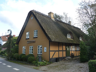 |
| Attractive thatched homes |
One
other feature we saw a number of times was the traditional ferry
“Helge” as she took tourists and others around the bay stopping
at, amongst other places, the Slot and the Sailing Club. Fine looking
vessel.
 |
| Helge approaching landing stage |
Saturday
morning was sunny; we couldn't believe what a good spell of weather
we had enjoyed since returning in August. The downside was that the
wind was again very light so all we could do was motor the 19nm W
past Svendborg on the island of Fyn and three small islands off the
coast of Fyn until we reached Lyo. This is another small island about
4km long and 3 km wide with a population of around 200. The very
pretty village is in the centre of the island about 15 minutes from
the small harbour where the ferry calls about five times a day.
 |
| The village pond in Lyo |
The
whitewashed Church has a circular graveyard, claimed to be the
loveliest in Denmark! No information on whether the incumbents agree!
It is certainly well maintained with miniature box hedges around
every plot and many flowers and shrubs.
 |
| The praised Chruchyard! |
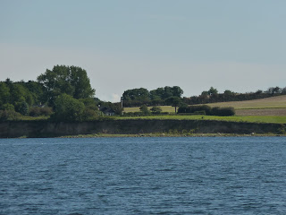
From there we walked to the
NW of the island passing a Dolmen from the early stone age and then
being able to view the reef and bird sanctuary. This is a flat
triangular spit surrounded by a salt meadow. Many birds breed here
earlier in the year, particularly arctic terns, little terns and
avocet but regrettably we couldn't spot any of these.
 |
| Bird sanctuary |
The
following morning we decided to thread our way around the islands the
short distance to the town of Faaborg which we had visited last year.
We achieved three objectives. We fuelled the boat; did some shopping
at Lidl; and had a smoked fish lunch at a popular little cafe on the
edge of the harbour that we had visited last year. After lunch we
returned the 5nm to Lyo but instead of mooring in the harbour we joined a couple of other boats anchored off the sand spit and had a peaceful evening and night in
the bay.
 |
| Beautiful evening anchored off Lyo |
On
Monday we weighed anchor and headed NW towards the island of Als.
Despite the wind gradually becoming WNW we were able to sail for a
while as we headed to the N of the island. We rounded this and then
turned S and with the wind having dropped slowly made our way through
Als Fjord and then into Als Sund both of which separate the island
from Jutland. Both the Fjord and the Sund are beautiful with rolling
hills running down to the waters edge.
 |
| Als Sund |
After a 30 minute wait for a
lifting road bridge on the edge of the town we tied up alongside the
town quay in Sonderborg.
 |
| Whileaway on Sondorborg Town Quay |
The
busy town is a large shopping centre and has a mix of old and new
buildings, some of the latter the usual concrete eyesores that you
see in many places! It is a University town so that adds to the buzz.
 |
| New buildings dwarfing the old |
Sonderborg
is very near the border with Germany so has suffered from incursions!
The Prussians took possession of Jutland in the 1864 in a war in
which the Danes were forced to retreat to Als. After WW1 the
population were offered a referendum on whether they wished to return
to Denmark and they voted to do so, the change happening in 1920. Of
course, during WW2 the Germans again occupied Denmark. Not
surprisingly the second language here is apparently German rather
than English.
In
the afternoon we cycled 10km down the coast on an excellent
foot/cycle path to Horuphav, a sleepy village with a small harbour.
 |
| Basking seals sculpture on coast path |
It was another warm and sunny day although with cloud building.
Looking at the forecast it seems that we are now in for a period of
rain and strong winds as a low that has been bringing poor weather to
the UK, is set to push away the Baltic high that we have been
benefiting from.